Combining Clutter Height and Clutter Type
When selecting terrain data sources in Pathloss 6 the user must select which clutter data source to use. Clutter 1 is typically reserved for description-based clutter. Clutter 2 is typically used for height-based clutter. In fact, this is how the Managed Clutter Data selections are configured.
Whether using Managed Clutter Data or a manual clutter data configuration; if both Clutter 1 and Clutter 2 are configured, with a description-based clutter for Clutter 1 and a height-based clutter for the Clutter 2 then the user has the option of using the heights from Clutter 2 instead of the heights from the Clutter 1 index.
This is useful because description-based clutter such as NLCD uses a predefined set of heights, one height for each category. With this feature enabled, users can now extract more precise clutter height information from Clutter 2, particularly when using high resolution DSM data such as data from the USGS LIDAR Explorer. When using SRTM or coarser DSM data, users should still exercise caution when establishing clutter heights. For point to point link feasibility studies, a conservative estimate would assume that the SRTM tree heights are 50% of the actual values.
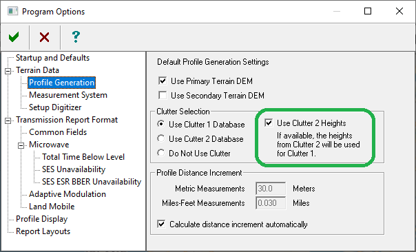
The option can be set in the Program Options - Profile Generation options pane:
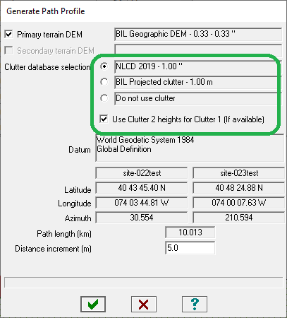
Or from the Generate Path Profile window:
Notes:
- This applies to any operation in Pathloss 6 where terrain data is used for profile generation, including Local and Area Studies.
- A conservative estimate would assume that the SRTM tree heights are 50% of the actual values.