Version 6.00.10 - Pre-release
Support for GeoJSON Vector Formats and Tiled Vector Building Data
Support for GeoJSON (.json) format vector files has been added to the vector system. These vectors can be added to the vector index by the usual method: Files - Import - Vector Files.
Tiled Vector Building Data Support
Building data is often distributed as vector tiles arranged in a folder tree. In this case, rather than adding the individual files, the entire folder structure can be added as a single vector entity. Click Files - Import - Vector Tile Folder. Select the top level folder of the tiled data. Double click on the Building Height Field and select the correct entry for your data-set. You can also change the color and attributes of the data-set from the Definition Table.
The data is now ready to use. In addition, any new files added to the folder structure will automatically be processed the next time that network or GIS file is loaded.
Vector Building Data can be obtained from a number of sources both free and commercial such as:
New 3D Antenna Discrimination Formulas
Pathloss 6 has adopted new formulas for determining total antenna discrimination when using both Azimuth and Elevation patterns. All relevant angles (azimuth, elevation departure angle, and antenna vertical tilt) are used in this calculation. This general solution produces a more accurate interpolation of the antenna pattern data. This is especially noticeable in cases of large elevation angles that might be found in local studies or interference cases.
Note that an antenna elevation pattern is required for this method to be fully utilized. If the antenna is marked as an aperture antenna, it is assumed to be symmetrical about boresight and the azimuth patterns will be used as the elevation pattern as well.
This method was taken from the latest TIA TR45 Working group publication. It was submitted by George Kizer using techniques from Gordon and Morgan, Principles of Communications Satellites. Pathloss 5 currently uses a similar but less complete version of this method. Pathloss 5 will be updated to use this solution as well.
Local Studies Initial Rework
This is the first part of a rework that will include more changes to the Local Study user interface, expanded display criteria, and exports.
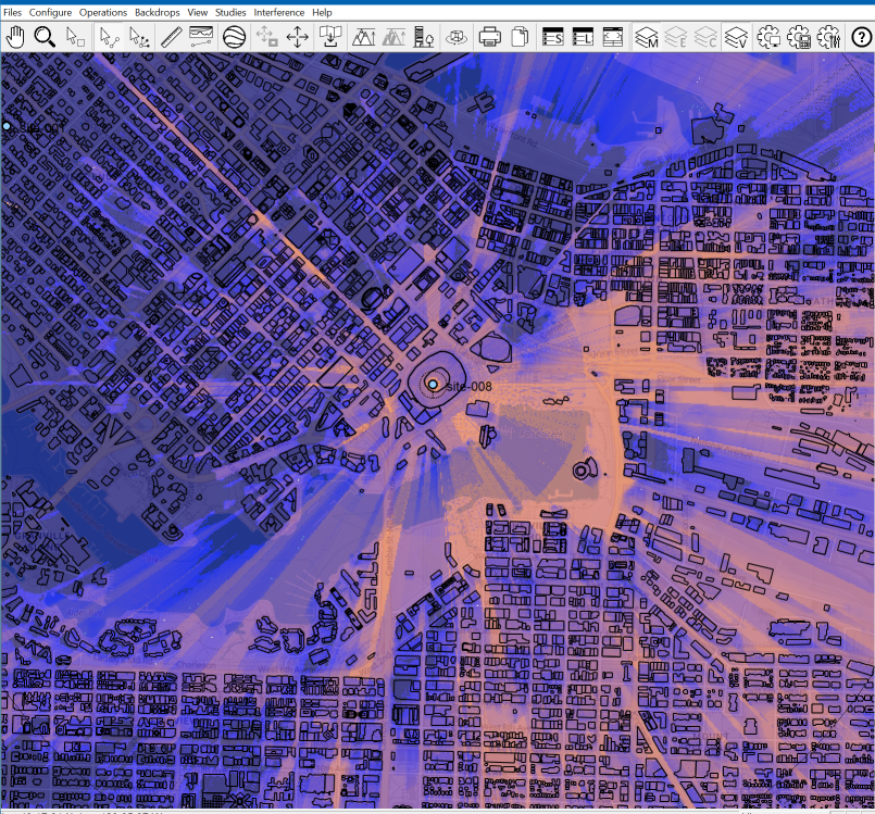
Local Studies have been updated to work with the tiled map backdrop. This includes a new back-end that will be more flexible in terms of radial creation, study shapes, and export possibilities. The usage is currently identical to version 5 except that the Tolerance value is not used. This will be removed from the UI in a future update.
In addition to this, the Local studies now consider vector building data in the radial profile calculations. Note that if a vector entry has a Building Height Field selected, other clutter databases are suppressed. (i.e., If Building heights are being used, other clutter data will not be used.)
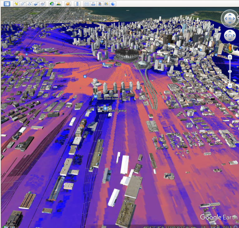
This can also be exported to Google Earth KMZ. Click Files-Export-Google Earth KMZ
FCC ULS Database Integration
 Pathloss 6.00.10 includes the beta release of the FCC ULS Database integration. Users working in North America can download the FCC’s ULS data and use it in Pathloss to perform interference calculations against Pathloss designs. This feature is only available with the Interference option.
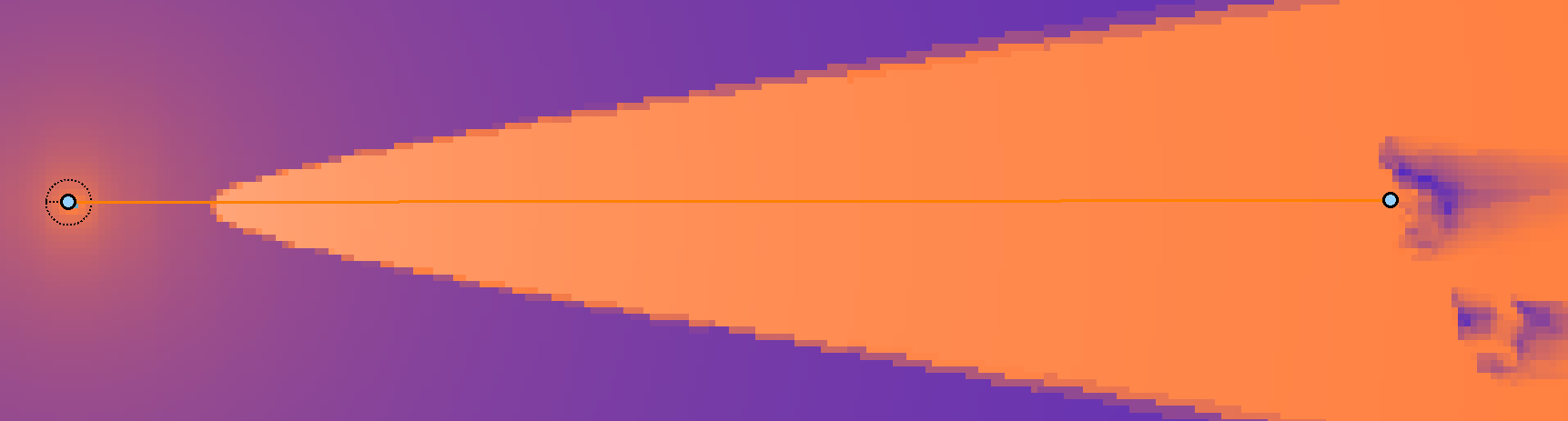
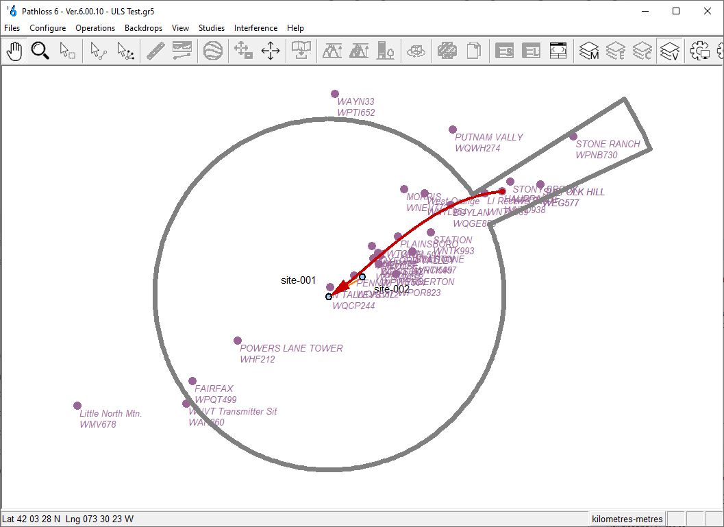
Licenses requiring coordination are displayed graphically in the new Browse Interference cases window. The NSMA defined coordination area is displayed along with the stations that met the interference objective. The user can toggle though the cases and sub cases and the interfering path is displayed. Users can click on an interfering site, and the site details are displayed. This initial release displays the following information:
- Site name
- Callsign
- Owner details and contact information
- All coordinating stations for the license
The download process is fast and simple using the dedicated ULS Data Download (UDD) program. New License data is published every Sunday on the FCC website.
This is the beta release for this functionality and is still being actively developed. Future functionality includes:
- PCN (Prior Coordination Notice) automatic generation for all cases.
- Frequency searches
We are especially interested in feedback on user’s workflow and how this new functionality can be best tailored to their needs.
Notes and Limitations
The FCC ULS Applications Database is not yet supported.
Currently the interference calculations are one way, meaning, the user can only calculate the impact or interference on the selected Pathloss designs, not interference or the impact on licenses in the ULS Database.
Instructions for use
Download the Data
Download the data using the ULS Data Download (UDD) program. This program is located in the Pathloss 6 folder in the Start menu.

Click Download ULS and the data will be downloaded and converted.
Configure Pathloss to use FCC ULS Database
Configure Pathloss to use the data by clicking Interference-Database-Configure FCC ULS Database in the main window.
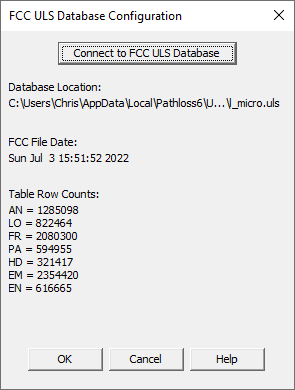
Clicking the Connect to FCC ULS Database will automatically open the default database loacation. Select the l_micro.uls data file and click Open. Some information about the table is displayed and the table is now ready for use.
Using the FCC ULS Database in an Interference Calculation
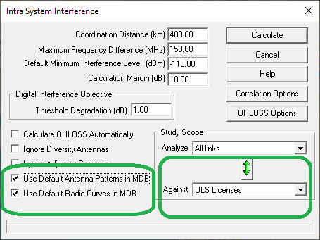
To use the data in a calculation, select ULS Licenses from the choices in the Against drop-down list. The Use Default Antenna Patterns in MDB and Use Default Radio Curves in MDB option will also need to be checked.
Graphically Browsing Interference cases
Once the calculation is complete click Interference-Browse Interference Cases. The green up and down arrows toggle between cases and the red left and right arrows toggle between sub-cases.
